

Featured Publications
2026
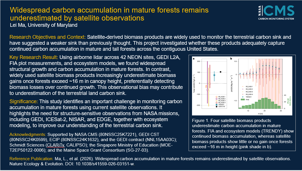 |
August 2026 Widespread carbon accumulation in mature forests remains underestimated by satellite observations DOI: 10.1038/s41559-026-03151-w Project(s): Hurtt (CMS 2023) |
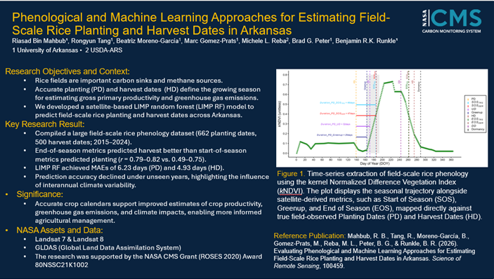 |
July 2026 Evaluating phenological and machine learning approaches for estimating field-scale rice planting and harvest dates in Arkansas DOI: 10.1016/j.srs.2026.100459 Project(s): Runkle (CMS 2020) |
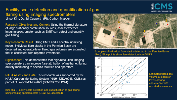 |
June 2026 Facility scale detection and quantification of gas flaring using imaging spectrometers DOI: 10.31223/x5r78p Project(s): Cusworth (CMS 2022) |
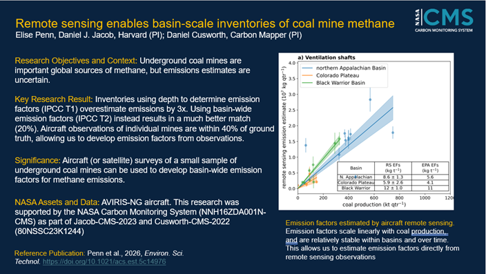 |
June 2026 Remote Sensing Enables Basin-Scale Inventories of Coal Mine Methane DOI: 10.1021/acs.est.5c14976 Project(s): Cusworth (CMS 2022); Jacob (CMS 2023) |
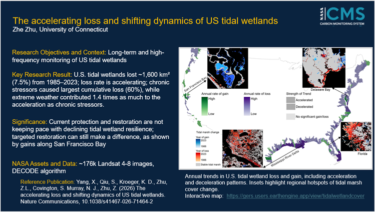 |
May 2026 The accelerating loss and shifting dynamics of US tidal wetlands DOI: 10.1038/s41467-026-71464-2 Project(s): Kroeger (CMS 2022) |
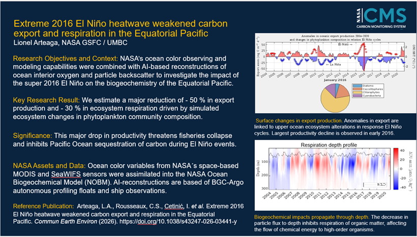 |
May 2026 Extreme 2016 El Nino heatwave weakened carbon export and respiration in the Equatorial Pacific DOI: 10.1038/s43247-026-03441-y Project(s): Arteaga (CMS 2022) |
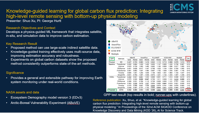 |
May 2026 Knowledge-Guided Learning for Global Carbon Flux Prediction: Integrating High-Level Remote Sensing with Bottom-Up Physical Modeling Project(s): |
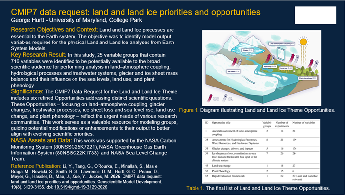 |
April 2026 CMIP7 data request: land and land ice priorities and opportunities DOI: 10.5194/gmd-19-3129-2026 Project(s): Hurtt (CMS 2023) |
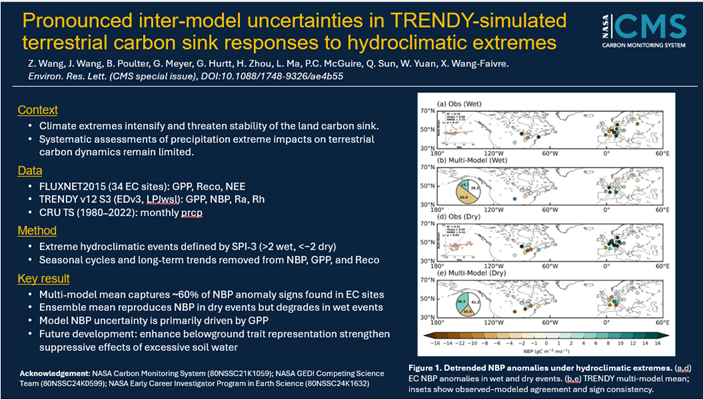 |
April 2026 Pronounced inter-model uncertainties in TRENDY-simulated terrestrial carbon sink responses to hydroclimatic extremes DOI: 10.1088/1748-9326/ae4b55 Project(s): Hurtt (CMS 2020); Hurtt (CMS 2023) |
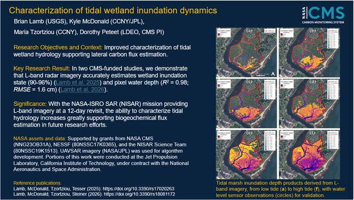 |
April 2026 Tidal Wetland Inundated Volume Estimates Using L-Band Radar Imagery and Synthetic Tide Gauging DOI: 10.3390/rs18081172 Project(s): Peteet (CMS 2022) |
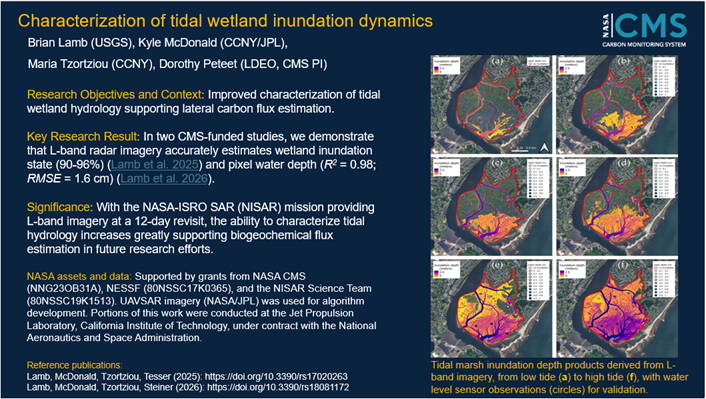 |
April 2026 Characterizing Tidal Marsh Inundation with Synthetic Aperture Radar, Radiometric Modeling, and In Situ Water Level Observations DOI: 10.3390/rs17020263 Project(s): Peteet (CMS 2022) |
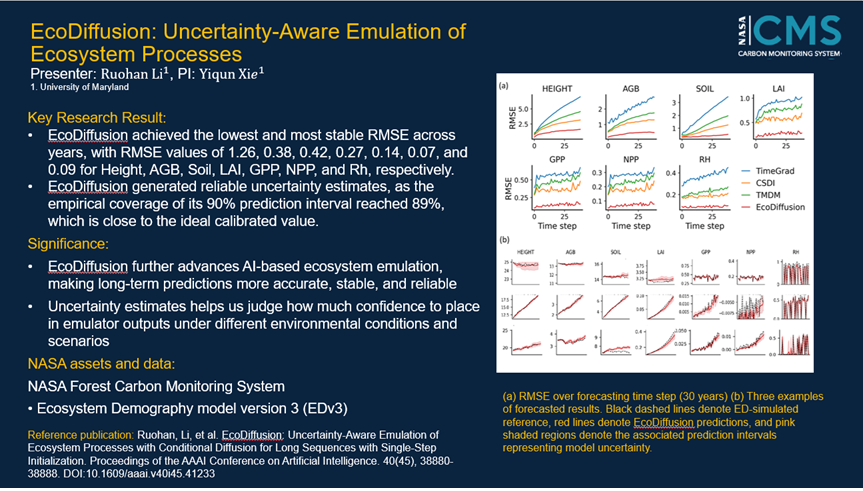 |
March 2026 EcoDiffusion: Uncertainty-Aware Emulation of Ecosystem Processes with Conditional Diffusion for Long Sequences with Single-Step Initialization DOI: 10.1609/aaai.v40i45.41233 Project(s): Hurtt (CMS 2023) |
 |
March 2026 Significant Influence of Lateral Carbon Fluxes on Regional U.S. Carbon Budgets DOI: 10.1029/2025GB009020 Project(s): Davis (CMS 2020); Liu (CMS 2023) |
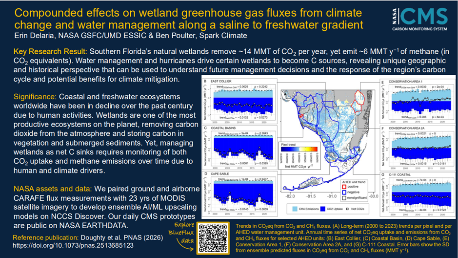 |
March 2026 Compounded effects on wetland greenhouse gas fluxes from climate change and water management along a saline to freshwater gradient DOI: 10.1073/pnas.2513685123 Project(s): Delaria (CMS 2023) |
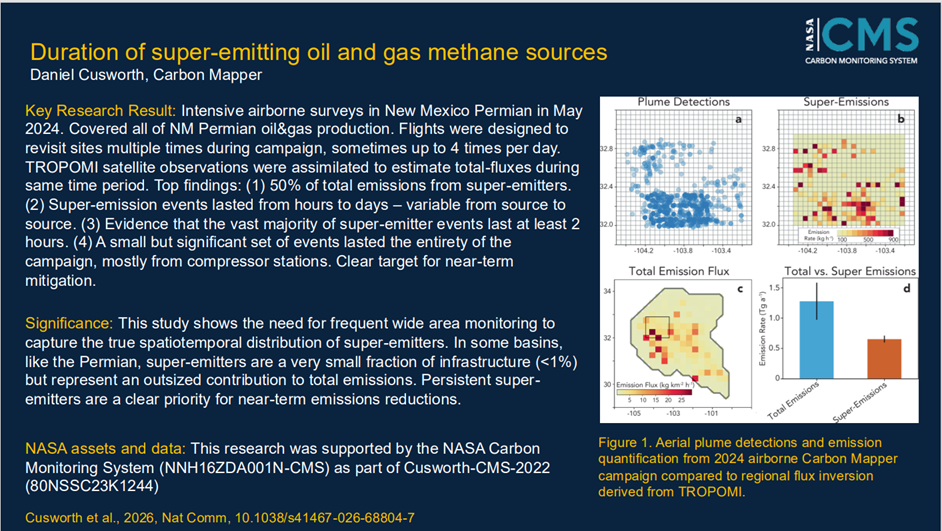 |
March 2026 Duration of super-emitting oil and gas methane sources DOI: 10.1038/s41467-026-68804-7 Project(s): Cusworth (CMS 2022) |
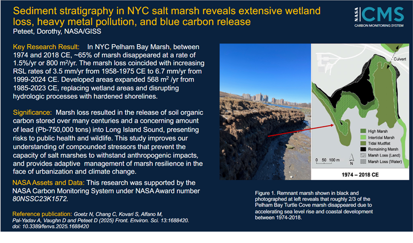 |
February 2026 Sediment stratigraphy in NYC salt marsh reveals extensive wetland loss, heavy metal pollution and blue carbon release DOI: 10.3389/fenvs.2025.1688420 Project(s): Peteet (CMS 2022) |
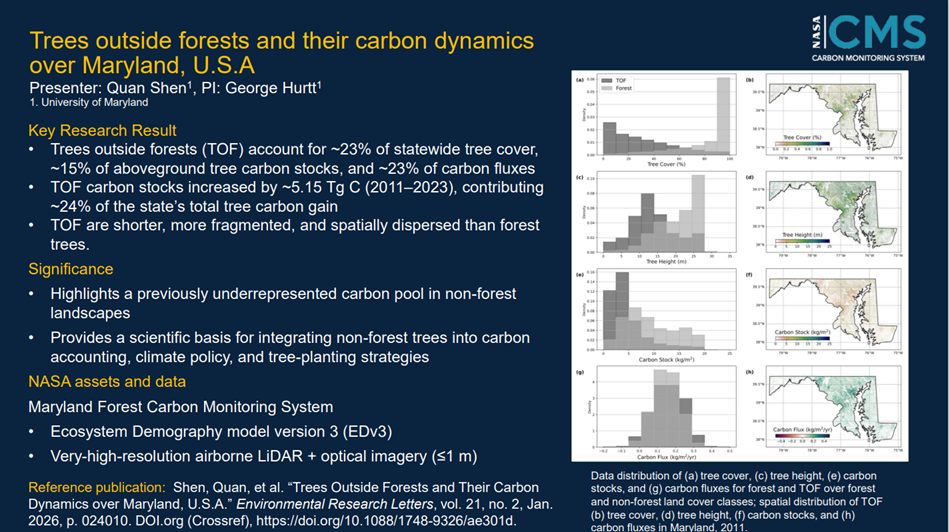 |
February 2026 Trees outside forests and their carbon dynamics over Maryland, U.S.A DOI: 10.1088/1748-9326/ae301d Project(s): Hurtt (CMS 2020); Hurtt (CMS 2023); Hannun (CMS 2020) |
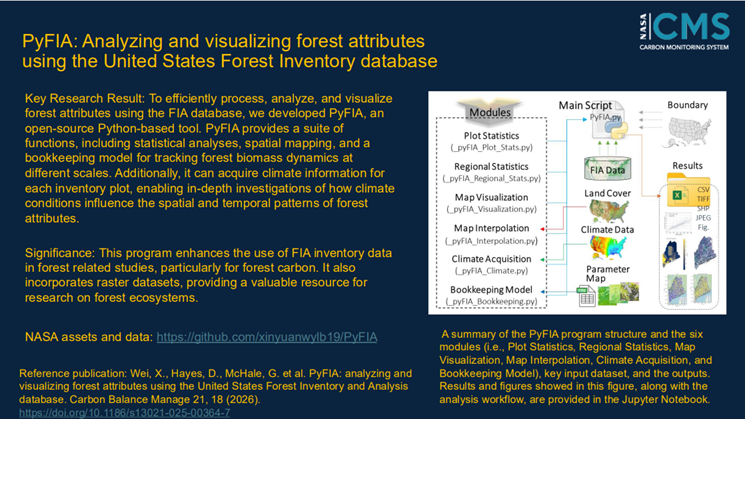 |
February 2026 PyFIA: analyzing and visualizing forest attributes using the United States Forest Inventory and Analysis database DOI: 10.1186/s13021-025-00364-7 Project(s): Hayes (CMS 2020); Hayes (CMS 2023) |
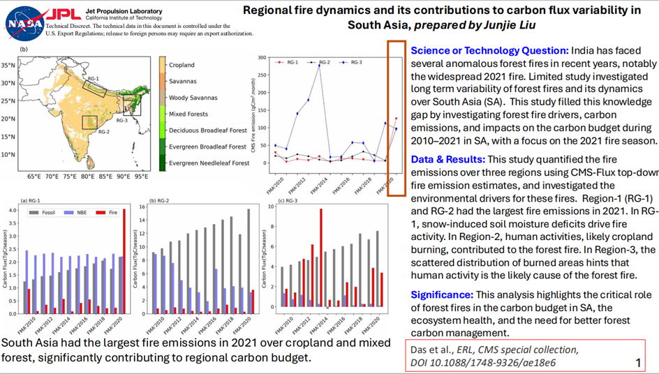 |
February 2026 Regional fire dynamics and its contributions to carbon flux variability in South Asia DOI: 10.1088/1748-9326/ae18e6 Project(s): Chatterjee (CMS 2023); Liu (CMS 2023) |
2025
 |
October 2025 Detecting the onset of rice field inundation in the Lower Mississippi River Basin via Harmonized Landsat Sentinel-2 (HLS) satellite time series DOI: 10.1016/j.isprsjprs.2025.07.003 Project(s): Runkle (CMS 2020) |
+ View Archive
- NASA Official: Jon Ranson
- Curator: Leanne Kendig